

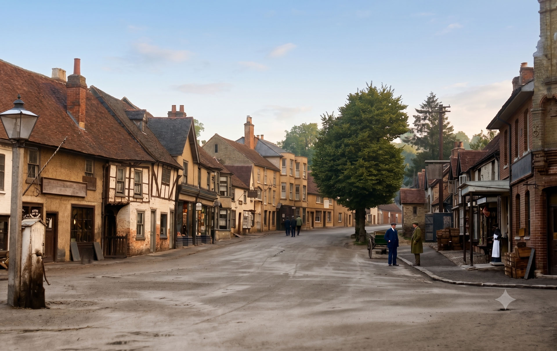
If you have ever found yourself stuck in traffic on the A413, staring out at the Buckinghamshire rolling hills and wondering where it all went right for the local property market, welcome to Chalfont St Giles. This is a landscape built on three things: pristine chalk, ancient beech trees, and affluent commuters who work from home at rates that would make an office manager weep.
But beneath this outer-metropolitan surface lies a history that is deep, thoroughly documented, and occasionally weird. This isn’t a story of a sleepy, isolated village. Rather, Chalfont St Giles has spent the last thousand years acting as an unwitting backdrop for some of the most dramatic moments in British history.
Chapter 1: The Chalk, the Spring, and the Angry Etymologists
Before we can talk about the people, we have to talk about the mud. Topographically speaking, Chalfont St Giles sits snug within the Misbourne Valley, a classic Chiltern chalk stream system. The underlying bedrock is made of the Seaford and Newhaven Chalk Formations, which naturally filter the local water supply until it is heavily impregnated with calcium carbonate. This is excellent for brewing beer, but absolutely lethal to the heating elements of electric kettles.
This distinct hydro-geology gave the village its name, though it took local academics an embarrassingly long time to agree on why. For decades, the prevailing theory—cooked up by the English Place Name Society in 1925—was that “Chalfont” derived from a Saxon gentleman named Caedel, who allegedly owned a spring (funta) here around AD 949.
The Caedel hypothesis was an elegant piece of historical fiction. Modern archival digging has shown that the AD 949 charter in question actually concerned a land grant in Reculver, Kent, and didn’t contain anyone named Caedel at all.
Instead, the true linguistic root was found in a twelfth-century copy of an AD 796 land grant for “Pinesfeld” (modern-day Pynesfield near Rickmansworth). The text traces a boundary line running “on Cealcfuntinga gemaerhagan”—meaning “to the boundary enclosure of the people of the chalk spring.” So, by the time the Norman surveyors rolled into town in 1086 and recorded the settlement as Celfunte, they were just butchering the Old English term for a very lime-heavy well.
The suffix “St Giles” was later tacked on in 1237 to distinguish it from its neighbor, Chalfont St Peter. Saint Giles was the patron saint of cripples and outcasts, and churches dedicated to him were traditionally built outside town walls or at the bottom of steep valleys.
Cultural Note: For reasons best left to the complex psychology of the capital, London vernacular eventually adopted the village name as Cockney rhyming slang. If someone in a London pub tells you their “chalfonts” are acting up, they aren’t talking about their historic property portfolios—they are referring, colorfully, to hemorrhoids.
Chapter 2: Flint, Iron, and Pig Food: The Early Landscapes
The human occupation of this valley stretches back to a time when “commuting to London” meant chasing a woolly mammoth on foot. Major infrastructure projects like the M25 widening and the construction of the High Speed Two (HS2) rail line have acted as accidental time machines for local archaeologists.
Excavations near Junctions 16 and 17 of the M25 revealed late Neolithic and early Bronze Age Beaker pottery pits. By the Middle Iron Age (circa 400–100 BC), the locals had scaled up operations, establishing a timber-framed agricultural enclosure and an early iron smelting site at Slade Oak Lane. They were extracting local ironstone from the clay-with-flints capping on the downs and refining it right here in the valley.
When the Romans took over, they formalized the landscape. High-resolution Light Detection and Ranging (LiDAR) data captured across Hodgemoor Woods has revealed that what looks like ancient forest today was once a busy Roman rural settlement. The trees hide a network of field boundaries, a projected Roman road running roughly along Vache Lane, and various circular craters. These weren’t bomb sites; they were Roman industrial extraction pits where clay was dug for bricks, gravel for roads, and chalk for “marling” (fertilizing) fields.
When the Domesday Inquest was drawn up in 1086, Chalfont St Giles was recorded as a substantial, economically mixed manor held by Manno the Breton. The entry details an estate containing:
- Land sufficient for 15 ploughs
- 13 villeins (feudal peasants tied to the soil)
- 8 bordars (smallholders)
- 4 serfs
- 3 watermills
- Woodland capable of supporting 600 foraging swine
- A recorded falcon eyrie (the medieval equivalent of a helipad, denoting high aristocratic status).
The three Domesday watermills set off a milling tradition along the Misbourne that lasted for centuries. The most prominent survivor, Chalfont Mill, sits half a mile north of the village. It transitioned from grinding grain for medieval monks to spinning silk with a four-horsepower waterwheel in the nineteenth century.
Chapter 3: The Pillars of Saint Giles: Medieval Murals and Civil War Pikes
If you want to feel small, stand inside the Church of Saint Giles. Built between 1150 and 1180, its thick walls are composed of flint, clunch (hard chalk), and chunks of limestone.
The original Norman church was a modest affair, but during the Early English period (circa 1200–1275), the chancel was extended to an impressive 40 feet. If you look closely at the central aisle, you will notice that the chancel has a distinct southward tilt relative to the nave. This wasn’t bad medieval engineering; it was an intentional allegorical design representing the inclined head of Christ on the cross.
When the church was expanded further in the fourteenth century, the builders decided to upgrade the sturdy, round Norman pillars of the south arcade to match the fashionable octagonal columns of the new north aisle. Rather than replacing them, they simply took chisels and rudely hacked the round columns into octagonal shapes. The uneven tool marks are still completely visible.
In the mid-fourteenth century, the interior was covered in vivid biblical frescoes. These weren’t for decoration; they were a visual medium for a largely illiterate congregation. During the Reformation, these “popish” images were plastered over and replaced with whitewash. It wasn’t until Victorian restoration crews began scraping the walls in the nineteenth century that the murals were rediscovered, including depictions of:
- The Crucifixion and the Resurrection
- The Tree of Jesse (a family tree of Christ)
- Saint John the Baptist being beheaded
- An angel weighing souls while a desperate devil tries to tip the scales.
Fast forward to 1642, and the church became a literal barracks. Following the Battle of Aylesbury, Oliver Cromwell’s Parliamentary forces encamped in the adjacent marshy pastures of Silsden Mead. The troops quartered inside the church, leaving lead musket shot in the oak rafters and firing small iron cannonballs that became embedded in the stonework around the east window.
Years later, six triangular-headed “Cromwell Pikes”—crudely fashioned from old metal files—were discovered hidden in the tower ringing chamber, stashed away by nervous villagers who wanted to be ready for the next time an army decided to use their house of worship as a dormitory.
Chapter 4: Regicides, Blind Poets, and the World’s First Global Monument
The grandest estate in the parish is The Vache, bought in 1564 by Thomas Fleetwood, Under Treasurer of the Royal Mint. His grandson, George Fleetwood, became one of the most radical political figures of the seventeenth century. When the English Civil War broke out, George raised a troop of dragoons from the Chilterns for Parliament, rose to the rank of Colonel, and in January 1649, sat as a commissioner at the trial of King Charles I. His signature appears forty-fifth on the King’s death warrant.
This proved to be a catastrophic career move when the monarchy was restored in 1660. Fleetwood pleaded guilty to regicide, claimed he had been bullied into signing by Cromwell, and barely escaped the gallows. He was stripped of The Vache and sentenced to life imprisonment, eventually dying in exile in Tangiers.
While Fleetwood was rotting in prison, Charles II handed the estate to his brother, the Duke of York, who sold it to Sir Thomas Clayton. Clayton was a fierce Royalist who took great pleasure in executing the Great Ejectment of 1662, stripping the local Puritan rector, Thomas Valentine, of his living. In retaliation, George Fleetwood’s brother, Charles, allowed the newly illegal non-conformist congregation to meet secretly in the woods of the Vache estate.
Meanwhile, at the southern end of the village, a different kind of history was being written. In the plague summer of 1665, the blind poet John Milton fled the disease ridden streets of London. His Quaker friend and pupil, Thomas Ellwood, rented him a modest, timber-framed cottage in Chalfont St Giles.
Milton arrived with his third wife, his fourteen-year-old daughter Deborah (who acted as his scribe), and the completed manuscript of his masterpiece, Paradise Lost. It was in this cottage that he made his final revisions to the text.
When Ellwood was released from an illegal-assembly stint in Aylesbury jail, he visited the cottage, read the manuscript, and famously asked: “Thou hast said much here of ‘Paradise Lost’: but what hast thou to say of ‘Paradise Found?'”Milton sat in a silent muse. After returning to London, he showed Ellwood the completed manuscript of Paradise Regained, noting: “This is owing to you, for you put it into my head by the question you put to me at Chalfont.”
In 1887, American developers attempted to buy the cottage, plan to dismantle it, and ship it to the United States. A local campaign, backed by a £20 donation from Queen Victoria, rescued the property, turning it into one of the oldest writer’s house museums in the world.
A century later, The Vache was purchased by Admiral Sir Hugh Palliser, a naval commander who recognized the talent of a young cartographer named James Cook. When Cook was killed in Hawaii in 1779, a grieving Palliser erected the world’s first monument to the explorer in the northern parkland of The Vache.
The monument is a bizarre, two-story open castellated flint tower surrounded by a miniature moat. Inside, a stone pedestal features a carved globe and an extensive, multi-faced Latin and English eulogy celebrating Cook’s navigational genius and his efforts to protect his crew from scurvy.
Chapter 5: The Quaker Westminster Abbey and the Mayflower Myth
Southwest of the main village lies the hamlet of Jordans, widely considered the “Westminster Abbey of Quakerism.” In the mid-seventeenth century, the Society of Friends was an illegal, underground movement. Local Quakers met clandestinely in the kitchen of Jordans Farm (now Old Jordans), defying the Conventicle Acts under constant threat of arrest by local magistrates.
In 1671, the Quakers bought a small sloped piece of land called Well Close for £4 10s to use as a burial ground, because non-conformists were banned from consecrated Anglican cemeteries. This sloped graveyard contains the remains of William Penn (the founder of Pennsylvania), Thomas Ellwood, and Isaac Penington. To reinforce the core Quaker testimony of absolute spiritual equality, all original headstones were removed in the early eighteenth century; the simple, uniform stone markers seen today were added in the mid-nineteenth century as calculated placeholders.
Following James II’s Declaration of Indulgence in 1687, the congregation built the Jordans Friends’ Meeting House in just three months. Constructed of red brick laid in Flemish bond, the interior is an exercise in radical simplicity: unpolished deal paneling, an orange brick floor laid directly onto the bare earth, and a massive movable wooden screen fitted with shutters to divide the room.
Adjacent to the meeting house is the Mayflower Barn, built in 1624 by Thomas Russell. In 1920, an eccentric Quaker scholar named James Rendel Harris put forward a theory that electrified the transatlantic community: he claimed the barn was built using salvaged timbers from the historic ship Mayflower.
Harris pointed out that the Mayflower was broken up in London in 1624, that the barn’s dimensions matched the ship’s inventory, and that one of the main supporting beams featured a distinct structural crack that perfectly aligned with historical accounts of a beam failure during a mid-Atlantic storm. While modern architectural historians view the link as romantic speculation rather than proven fact, the symbolic connection was so powerful that in 1921, a piece of timber from the barn was officially gifted to the United States and installed in the Peace Arch on the US-Canada border.
Chapter 6: The Secret War: Special Training School 42
When World War II arrived, the quiet valleys of Chalfont St Giles were pulled into the global intelligence network. The focus of this activity was Roughwood Park, a grand late nineteenth-century mansion that had been purchased in 1935 by the wealthy shipping magnate Sir John Ellerman.
In 1941, the War Department requisitioned the estate. To the local postman, it was occupied by the “Inter-Service Research Bureau” (the standard bureaucratic cover name for the Special Operations Executive, or SOE). In top-secret official correspondence, the property disappeared entirely, replaced by the designation STS 42 (Special Training School 42).
Contrary to local folklore, Winston Churchill did not personally scout the location or spend his weekends hiding out in the village. While Churchill’s War Cabinet created SOE in June 1940 (issuing the directive to “set Europe ablaze”), Roughwood Park was selected and run by military administrators.
Under the command of its chief instructor, Major Vernon Blomfield (whose private papers and accounts of Operation Bergamote survive in the Imperial War Museum), STS 42 functioned as an elite training and holding school for SOE’s F Section (France).
The exact day-to-day syllabus remains classified or lost, but personnel files released to the National Archives reveal that agents sent to Roughwood were put through a brutal curriculum designed to keep them alive behind enemy lines:
- Advanced small arms handling and silent killing techniques
- Bomb-making and tactical demolitions using plastic explosives
- Close-quarters combat and jujitsu
- Map-reading, night navigation, and the use of concealment devices
- Exacting physical conditioning across the Chiltern ridges.
The estate also served a more psychological function. It was used as an “Operational Holding School” where agents could recuperate between missions or receive “top-up” training.
Jacqueline Nearne, a key F Section courier who spent over a year operating in occupied France, was sent to Roughwood in 1944 to recover her health while acting as a training consultant. Her file features a detailed appraisal written during her stay.
Recent research by Amersham Museum indicates that Noor Inayat Khan, the heroic wireless operator who was later executed at Dachau, also spent time at Roughwood under a cloud of tight security shortly before being flown into France in June 1943.
By late 1944, records suggest STS 42 also took on a more somber role as a high security holding center for trainees who had washed out of the program or suffered psychological breakdowns, keeping them isolated from the public until their knowledge of operational secrets was no longer a security risk to the upcoming Allied advance.
Chapter 7: Little Poland in Hodgemoor Woods
The end of the war did not bring an end to the parish’s relationship with international conflict. In 1946, the British War Office and Buckinghamshire County Council faced a diplomatic and humanitarian crisis: thousands of Polish soldiers who had fought under British command were uniformally stranded. Following the Yalta Agreement, their homeland had fallen under a Soviet-backed communist regime; if these men returned, they faced immediate imprisonment, show trials, or execution.
The solution was built out of corrugated iron. A 250-acre reception and resettlement camp was established within the thick canopy of Hodgemoor Wood, situated between Chalfont St Giles and Seer Green. The camp was populated primarily by veterans of the Third Carpathian Rifle Division of the Polish II Corps—men who had fought their way through Tobruk and led the final, bloody assault on Monte Cassino.
At its peak in the 1950s, the Hodgemoor camp—known affectionately as “Little Poland”—housed over 156 families and more than 600 residents. Split into the “Top Camp” and “Bottom Camp” along Bottrells Lane, the settlement was constructed out of military Nissen huts and prefabricated wooden barracks. Conditions were primitive; the huts were damp, cold, and prone to flooding during Chiltern winters.
Despite the environment, the refugees constructed a fully functioning, self-contained society. They built a Polish primary school, a communal chapel, a post office, a local cooperative shop, a bakery, and small organic smallholdings.
The adult population became a vital labor source for regional post-war industry. Commuter coaches stopped at the edge of the woods every morning to collect workers for the furniture factories of High Wycombe and the Mars Confectionery plant in Slough.
The children attended the local Chalfont St Giles primary school, where they quickly integrated with local families. The camp remained active until 1962, when its residents saved enough capital to move into permanent brick housing in the surrounding towns.
Today, the Nissen huts are gone, and the woodland has reclaimed the clearings. The only physical marker left is a commemorative granite plaque and a memorial urn containing soil brought from the Katyn massacre site, a quiet reminder of a displaced community that made this valley its sanctuary.
Chapter 8: Quiet Villages and Loud Residents: The Modern Era
If you look at the demographic data for Chalfont St Giles today, you are looking at the classic profile of a premium commuter belt. According to the 2021 Census, the modern civil parish holds a stable population of 5,924 residents split across 4,412 households.
But when you widen the lens to the modern electoral ward (which includes the surrounding rural fringe, totaling 11,197 people), the structural reality of twenty-first-century village life becomes clear:
Census 2021 Ward Demographics at a Glance
| Demographic Metric | Local Statistical Total | Socio-Economic Significance |
| Total Residents | 11,197 | Broad regional catchment zone. |
| Managers, Directors & Seniors | 1,340 | High concentration of corporate decision-makers. |
| Professional Occupations | 1,299 | White-collar, knowledge-economy employment base. |
| Mainly Working from Home | 2,695 | High-speed broadband has replaced the morning train. |
| Households with No Car | 297 | Public transport is minimal; mobility requires wheels. |
| Households with 3+ Cars | 867 | Multi-vehicle properties dominate gravel driveways. |
This demographic shift from an agricultural community to a professional hub was accelerated by the arrival of the Metropolitan Railway in 1889. The station opened in the northern section of the parish and, at the explicit request of Rector Pownoll Phipps, was named “Chalfont Road” (later changed to Chalfont & Latimer in 1915).
The station sat at an intentional distance from the historic village center, which acted as a natural shield. While a new, dense commuter settlement grew directly around the tracks—formally named Little Chalfont by the parish council in 1925—the old village core preserved its timber-framed footprint. The separation became permanent in 2007, when Little Chalfont was officially sliced off to form its own independent civil parish.
This preservation of a picturesque historic setting made Chalfont St Giles an ideal target for film and television scouts. Over the last century, the village has spent a considerable amount of time playing other places on screen:
The Chalfont Filmography
- Poison Pen (1939): The village streets provided the backdrop for this classic pre-war drama of small-town malice.
- The Big Job (1965): The Crown pub on the High Street was completely transformed into a commercial bank for an elaborate comedy heist starring Sid James.
- Dad’s Army (1971): In the feature film adaptation, Chalfont St Giles doubled as the fictional seaside town of Walmington-on-Sea. The High Street hosted the Home Guard parades, and Captain Mainwaring’s bank office was set inside the historic village center.
- Hammer House of Horror (1980): The moody, timber-framed architecture opposite The Crown provided the perfect eerie setting for the episode “Visitor from the Grave.”
- The Canterbury Tales (2003): The BBC’s gritty, modernized adaptation of The Miller’s Tale utilized the local landscape to ground its rural setting.
The area’s combination of historical architecture, absolute privacy, and proximity to London also made it a magnet for eccentric, wealthy residents. The massive, Grade II listed country estate of Welders House, located in the Jordans quarter of the parish, was originally built in 1898 for the prominent politician Charles Thomson Ritchie.
In 1993, the estate was purchased by rock legend Ozzy Osbourne and his wife Sharon. Local oral history is full of colorful, unverified tales of the family’s tenure—including a persistent rumor that Sharon intentionally selected the property because there wasn’t a licensed pub within legal walking distance, a logistical hurdle that the Prince of Darkness allegedly spent years attempting to bypass.
Chapter 9: The Changing Face of the High Street
The commercial layout of the village has spent the last century undergoing a slow evolutionary shift. A walk down the High Street in 1950 would have revealed an independent retail ecosystem of grocers, drapers, bakers, and coal merchants.
Many of these historic premises are still identifiable through the statutory listings of the built environment. The Grade II structures along the High Street preserve the historic names of their former occupants directly within their legal addresses, such as the Premises of A J Axe & Sons, Staceys Cottage, and The Premises of Colin Lobering Butchers.
The retail properties show a clear line of commercial descent. The building known today as The Old Dairy was, in the 1950s, Dennison’s General Store and Tobacconist, which later transformed into Axe’s Hardware Store, before serving as a local Lloyds Pharmacy.
Similarly, the closure of The Crown Inn in 2013 marked the end of its life as a traditional village tavern; its conversion into a Costa Coffee in 2014 represents the modern reality of rural high streets, where corporate coffee chains preserve the external timber framing while completely re-ordering the social space inside.
To halt this commercial erosion, the Chalfont St Giles Parish Council launched a campaign in October 2011 to grant Asset of Community Value (ACV) status to the village’s five surviving historic public houses: The Merlin’s Cave, The Feathers, The Fox & Hounds, The White Hart, and The Ivy House.
Under the Localism Act, this designation places a legal barrier in front of speculative developers: if a pub owner attempts to sell the property, a statutory six-month freeze is triggered, giving local community trusts the first right to raise capital, match the valuation, and purchase the building to keep it functioning as a public space.
Conclusion: The Modern Contested Landscape
As Chalfont St Giles navigates the twenty-first century, it finds itself caught in an environmental paradox. It is a community that highly values its historic status, yet it is completely surrounded by national infrastructure projects. While the village pond and the River Misbourne continue to act as the visual symbols of local heritage, the underlying chalk aquifer is under severe twentieth-century strain.
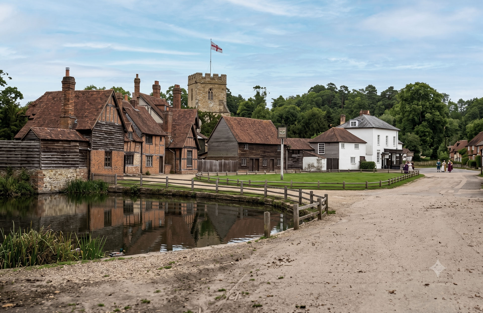
While the parish council had to make the painful decision to withdraw from the Buckinghamshire Best Kept Village Competition in 2024 due to the severe groundwater flooding and River Misbourne sewage pollution, they officially threw their hat back in the ring for 2025 as the waters finally receded.
The grand return was a massive triumph: Chalfont St Giles officially won the prestigious Pushman Cup in the 2025 competition.
It wasn’t just a casual win, either—the village absolutely crushed it, scoring a magnificent 196 out of a possible 200 marks. The judges were blown away by the massive community effort, giving special shout-outs to the community litter pickers, the volunteer-run library, the “Knit and Knatter” group (who clearly keep the local postboxes well-dressed), and the local scouts and guides who spent their weekends weeding the High Street.
The coveted cup was officially presented back to the community on the village green on September 20, 2025, proving that you can’t keep a good chalk-spring village down for long!
Today, Chalfont St Giles stands as a fascinating example of the English rural landscape: part prehistoric flint factory, part medieval sanctuary, part wartime intelligence hub, and part premium London dormitory. It is a place that has managed to keep its timber-framed heart intact, even while the modern world tunnels directly beneath its feet. Milton found his paradise here, the Polish found a sanctuary, and I’m just incredibly lucky to call it home.
You can download my research here chalfont-st-giles-history
